
Global technology company Emesent has partnered with leading software developer Deswik to enable mining companies to incorporate high-quality data captured in inaccessible locations into their mine plans and surveys.
Emesent is a leader in drone autonomy, LiDAR mapping, and data analytics. Founded in 2018, Emesent has since built a reputation for delivering high-quality data capture in the mining, infrastructure, survey and mapping industries.
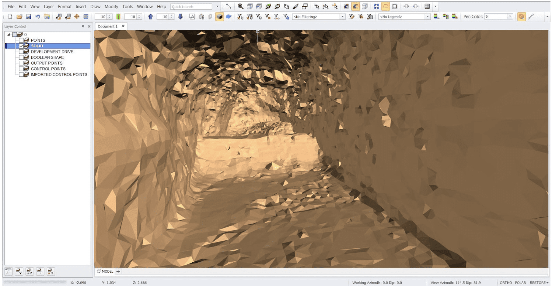
The company’s award-winning Hovermap is a drone autonomy and LiDAR mapping payload. It uses the LiDAR data and advanced algorithms on-board in real-time to provide reliable and accurate localisation and navigation without the need for GPS. This feature makes it ideally suited to map hazardous or underground environments where traditional data capture methods are difficult and dangerous.
Deswik is a global consulting and technology company which delivers efficiency-focused solutions to all sectors within the mining industry. Its mine planning and management platforms are used in over 500 mine operations around the world.
The two organisations have signed a Memorandum of Understanding to integrate their solutions to provide a more comprehensive solution to the resources sector.
In the first instance, a co-designed, semi-automated workflow has been created to import Hovermap data into Deswik’s design and solids modelling platform, Deswik.CAD. This workflow enables users to translate the Hovermap data within minutes, creating usable surfaces, solids and point clouds for as-built surveys, volume reporting and design updates.
“The data from Emesent’s Hovermap scanner can be imported into Deswik and visualized using any of the attributes that have been captured in the scan,” said Stephen Rowles, Deswik Survey Product Manager.
“The scan can be filtered, modified, and clipped to suit the user’s requirements before being processed in one or more of the dedicated functions for point clouds.”
Emesent CEO Dr Stefan Hrabar said the two companies were committed to working together to help mining companies increase the value of their models, by providing surveyors and planners with more accurate data from inaccessible areas.
“We’re excited about collaborating with another market-leading technology vendor in the resources sector,” Dr Hrabar said. “Integrating our respective solutions will assist customers to boost productivity and improve outputs.”
Deswik Partner Manager Patrick Doig said recent global events had piqued customer interest in technologies which allowed technical teams to collect high-quality data without the need to be physically present on site.
A partnership between Deswik and Emesent empowers their mutual and future customers to simplify processes, gain additional efficiencies and make value add decisions to their operations, Mr Doig added.
Read more Mining Safety News


